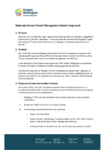
-
Pūrongo ā Tau 2025/26 | Annual Plan 2025/26
Tā mātou mahere mō te tau e tū mai nei
Our plan for the year aheadalarm Published 01 Jul 2025 -
-
Feasibility study of nature-based solutions for addressing flood risk to Masterton
This report presents the findings of a feasibility assessment to consider nature based solutions for flood risk management in the Waipoua Catchment. The feasibility assessment found that nature-based solutions (NBS)…
alarm Published 01 Jul 2025 -
-
Unconfirmed Public minutes of the Regional Transport Committee meeting on 24 June 2025
alarm Published 01 Jul 2025 -
-
Ruamāhanga Airborne Aquifer Mapping Project: Phase 2 hydrogeological model
This project utilises airborne electromagnetic survey technology (SkyTEM) to improve groundwater resource potential mapping and 3D modelling of the spatial extent of the potential aquifers within the Ruamāhanga Valley. This…
alarm Published 30 Jun 2025 -
-
A guide to exploring the Ruamāhanga SkyTEM data using the interactive mapping tool
Greater Wellington has used advanced electromagnetic survey technology called SkyTEM to learn more about what's below the Ruamāhanga Valley floor and identify where potential aquifers might be.
We’ve now made this…alarm Published 30 Jun 2025 -
Te Mahere Waka Whenua Tūmatanui o te Rohe Te Upoko o te Ika a Maui | Wellington Regional Public Transport Plan | 2025-2035
The Wellington Regional Public Transport Plan (RPTP) guides the design and delivery of public transport services, information and infrastructure in the Wellington region. The RPTP has a ten-year strategic focus with particular attention to…
alarm Published 27 Jun 2025